Visit BiH
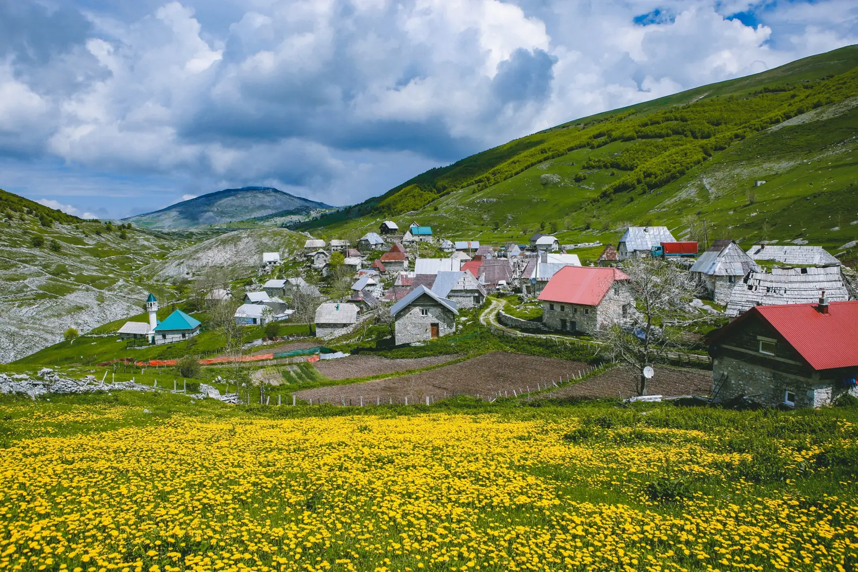
The village of Lukomir across a meadow of yellow dandelions, with stone houses and a small mosque below green slopes

Lukomir

  1. Home
  2. Places
  3. Sarajevo region
  4. Lukomir

The highest village in the country, on the rim of a canyon.

1,495mHigh country

Lukomir in brief. Lukomir is the highest and most isolated village in Bosnia and Herzegovina, at 1,495 metres on Mount Bjelašnica, about 50 km south-west of Sarajevo. Its stone houses with steep roofs stand on the rim of the Rakitnica canyon, which is 800 metres deep. Medieval tombstones show it has been lived in since at least the fourteenth century. The gravel road is open from about May to October; in winter the village is cut off by snow. Most visitors come on a day trip from Sarajevo, often walking the last stretch from Umoljani.

As far up as people live

No other settlement in the country stands above thirteen hundred metres. Lukomir is two hundred higher than that, on a shelf of grass with a mountain behind it and a canyon in front. The road to it is gravel, and for half the year it is not there at all.

Lukomir is a living village, not an open-air museum. Respect residents’ privacy, ask before photographing people or entering private property, and arrange meals or visits rather than assuming every household welcomes visitors.

It is tempting to call it a place where time has stopped. It has not. There are phones and solar panels and tin on some of the roofs. But the shape of the life, set by the snow, is very old, and you can still see it plainly.
What it is
The country’s highest village
Height
1,495 m
Houses
About 45
Lived in since
At least the 14th century
Road open
About May to October
Time needed
A full day from Sarajevo
From Sarajevo
About 50 km

The road closes

  1. Under the snowFrom late autumn the road disappears under metres of snow. Most families go down to the valley. A handful of old people stay, with their animals and their woodpiles.
  2. The road reappearsIn May the snow draws back and the track can be driven again. People come up to open their houses.
  3. The village comes homeSummer. Every house is lived in, the flocks are on the high pasture, and walkers arrive each day from Umoljani to eat pie and look into the canyon.
  4. Hay and woolThe grass is cut and stacked. The women knit thick socks and gloves to sell, in patterns their grandmothers used.
  5. Closing upThe first snow comes in October or November. One by one the chimneys go cold.

What to do in Lukomir

  • A hiker on the trail to Lukomir

    Walk in from Umoljani

    The best way to arrive. A marked trail runs along the rim of the canyon from the village of Umoljani, with the gorge on one side and open pasture on the other. Most people walk in and are driven out, or the reverse.

    Time needed
    About 3 hours one way
    Difficulty
    Moderate
    Season
    May to October
  • Stone houses in Lukomir

    Wander the village

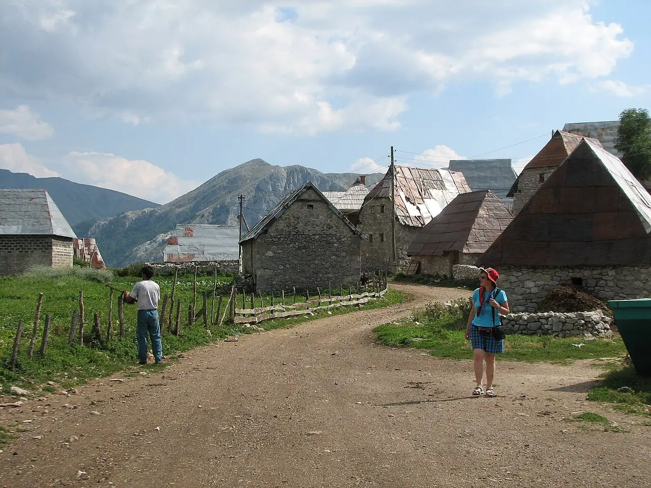
    It takes ten minutes to walk from one end to the other and an hour to do it properly. Look at the roofs, the woodpiles, the stacked hay and the sheepfolds.

    Time needed
    An hour
    Manners
    Ask before photographing people
    Entrance
    A lived-in village with no gate and no ticket. Stay on the lanes and out of the yards.
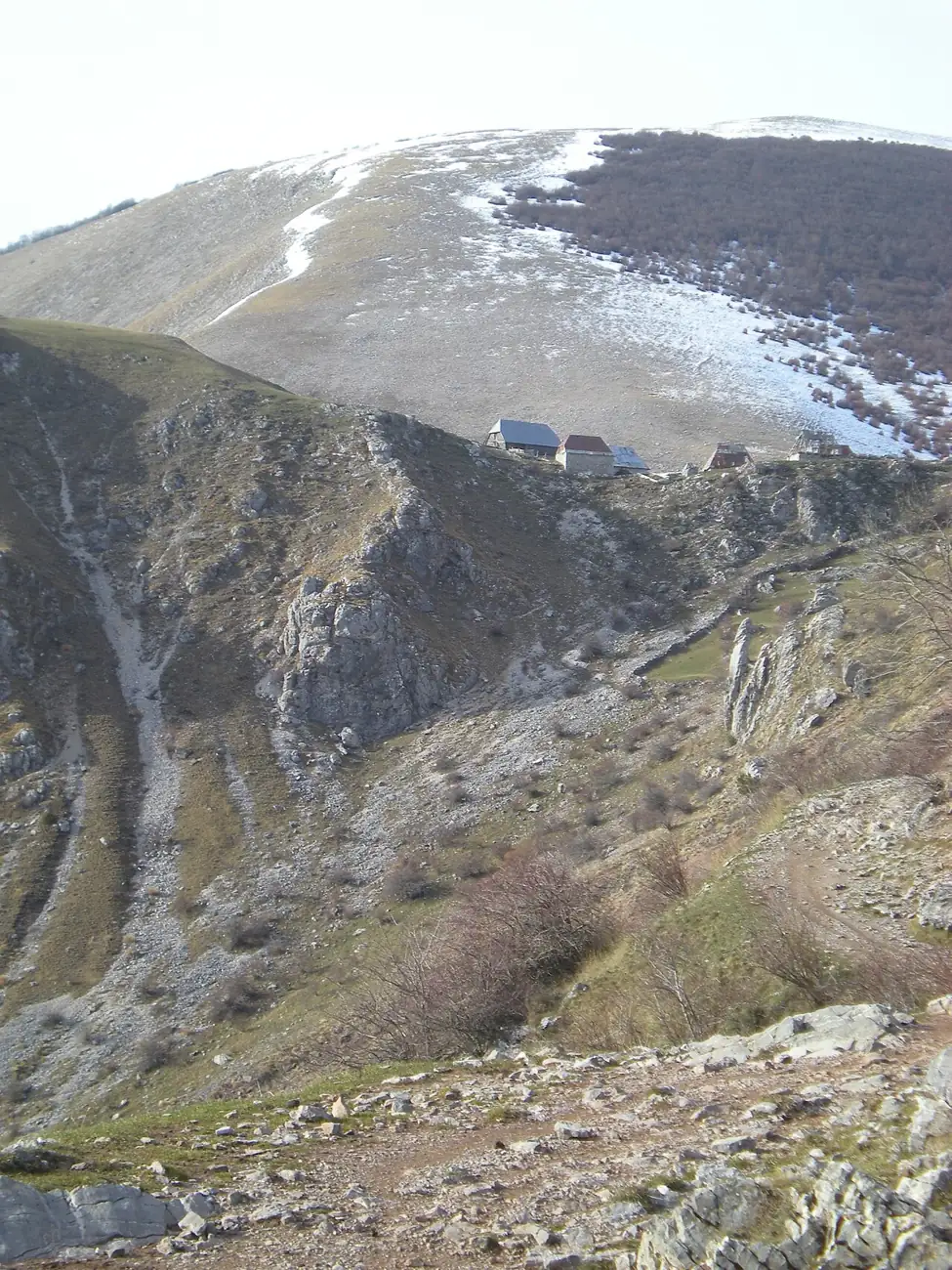
  • Lukomir seen from across the canyon, a cluster of roofs on a green shelf

    Go to the rim

    Past the last house, to the edge of the Rakitnica canyon and the medieval tombstones.

    Time needed
    30 minutes
    Care
    There is no fence
    Entrance
    Open ground beyond the last houses. Keep well back from the edge, more so in wind or mist.
  • Eat with a family

    Several households cook for visitors: pie with cheese, potato or greens, sour milk, and doughnuts with jam. Tell them when you arrive and it will be ready when you come back from the rim.

    What to order
    Pie, baked under coals
    Pay
    In cash
    Booking
    Not needed in summer
  • Buy something knitted

    The thick woollen socks, gloves and slippers sold at the doors are made in the village, and buying them is the most direct help you can give it.

    Where
    At the houses
    Pay
    In cash
    Good for
    Presents that last
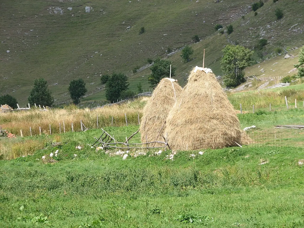
Low stone houses with tall, steep roofs along a dirt track in LukomirTwo tall haystacks in a mountain meadow at Lukomir

Built for the snow

There are about forty-five houses, and they all follow one pattern: low walls of rough grey stone, and above them a roof twice as tall as the walls, pitched so steeply that snow cannot settle on it.

The roofs were traditionally covered in wooden shingles, split by hand. Many now wear sheet metal. The village as a whole is a protected national monument.

In the fields around stand tall, pointed haystacks, each built round a pole, which is how the animals are fed through the winter.

Houses
About 45
Walls
Stone
Status
National monument

Good to know

Road
Gravel for the last stretch; passable by ordinary car in dry weather, slowly
Season
About May to October. Snow closes the road for the rest of the year
Weather
Cool even in August, and it changes fast. Bring a windproof layer
Shoes
Walking boots for the trail; sturdy shoes for the village
Money
Cash only. There is no shop and no cash machine
Facilities
Very few. Bring water
Phone signal
Patchy
In winter
Snow cuts the village off for months. Go only with a mountain guide who knows the conditions that week
Manners
It is a home, not a museum. Ask before you photograph people or go into yards

Mind the edge. The canyon rim is unfenced and the drop is sheer. Keep children close, and stay back in wind or mist.

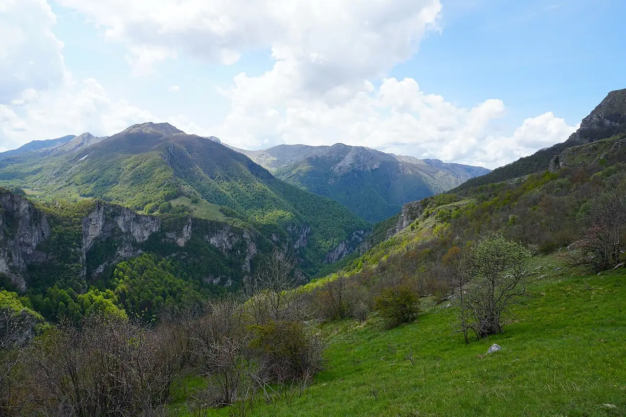
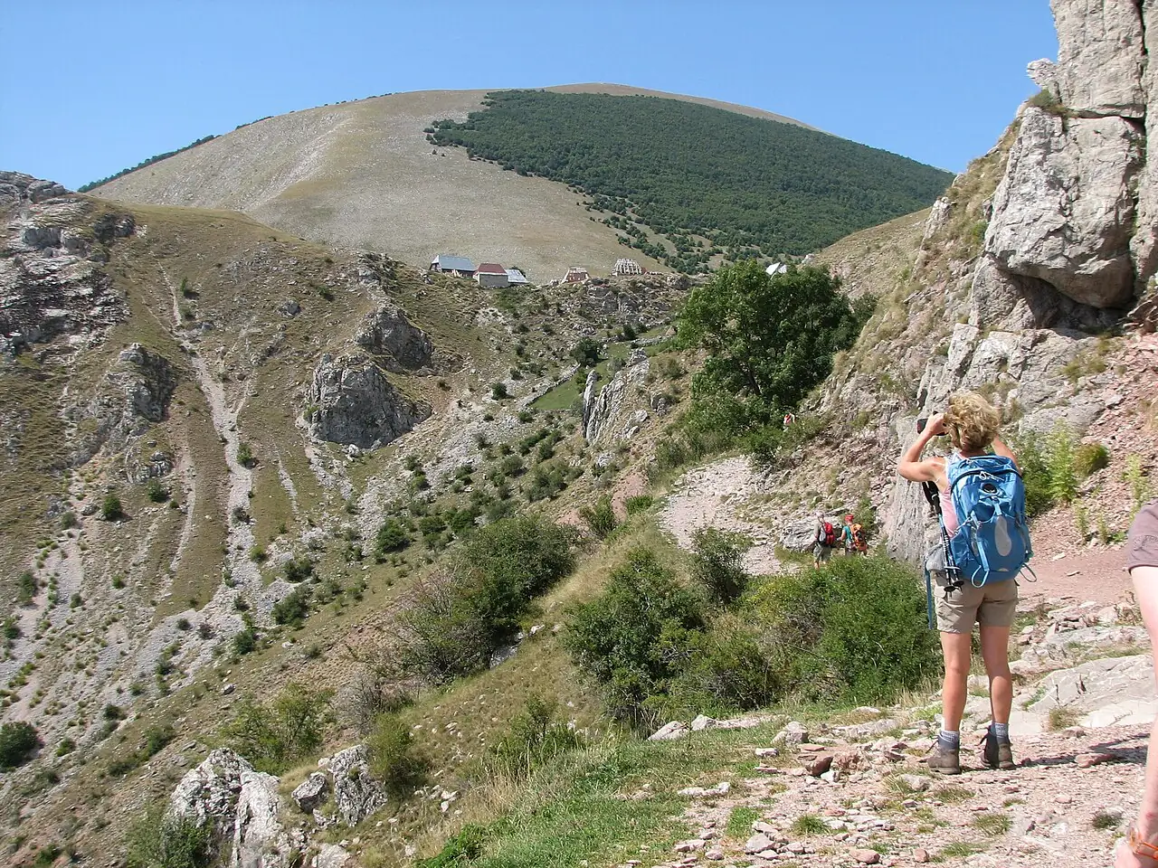
Green ridges falling away into the deep Rakitnica canyonA hiker on a rocky trail approaching Lukomir, with a broad mountain behind

The edge

Walk two minutes past the last house and the ground stops. Below your feet the Rakitnica has cut a canyon eight hundred metres deep, with no road and no path along its floor.

On the grass at the rim lie the stećci: medieval tombstones, great blocks of pale limestone, some carved, set here in the fourteenth and fifteenth centuries. They are the reason historians believe the village is at least six hundred years old.

Sit down beside them. This is one of the great views of the country.

The canyon
About 800 m deep
Tombstones
27, in two groups
From the village
A few minutes on foot

Where it is

12345

Outline from Natural Earth. Distances are by road and approximate.

Lukomir is on the southern side of Mount Bjelašnica, above the Rakitnica canyon, south-west of Sarajevo.

Getting to Lukomir

FromDistanceHowTime
SarajevoAbout 50 kmCar, or a guided trip1½ to 2 hours
Bjelašnica ski centreAbout 20 kmCar, on gravel45 minutes
UmoljaniAbout 3 hoursOn foot, along the canyon rim3 hours
KonjicAbout 60 kmCar, by mountain roads2 hours

There is no public transport. Without a car, join a guided day trip from Sarajevo. Distances and times are approximate.

A day in Lukomir

  1. To Umoljani

    Drive from Sarajevo over Bjelašnica to the trailhead.

  2. The rim trail

    Three hours’ walk, with the canyon beside you all the way.

  3. Pie in the village

    Ordered when you arrive, eaten when you come back from the edge.

  4. The rim and the stones

    Then a lift back down the gravel road.

Planning tips

Advice that comes up again and again from hikers and guides.

Where to stay and eat

Where to stay

A few households take overnight guests in simple rooms, and there is a small mountain lodge. Staying the night, when the day visitors have gone, is the best way to see the place.

What to eat

Pie, baked under a metal lid heaped with coals, filled with cheese, potato or wild greens. Sour milk, cream, and fried dough with jam.

Near Lukomir

Lukomir is the classic day out from Sarajevo.

Questions people ask

How high is Lukomir?

1,495 metres above sea level. It is the highest settlement in Bosnia and Herzegovina, and the only one above 1,300 metres.

When can you visit Lukomir?

From about May to October, when the gravel road is clear. For the rest of the year it lies under snow, and the village can be reached only on skis or snowshoes.

Do people live in Lukomir all year?

A few do, mostly elderly. Most families move down to the valley for the winter and return when the road opens in spring.

How do you get to Lukomir from Sarajevo?

By car in about an hour and a half to two hours, roughly 50 km over Mount Bjelašnica, the last part on gravel. Many visitors join a guided day trip that includes the hike from Umoljani.

How long is the hike from Umoljani to Lukomir?

About three hours one way, on a marked trail along the rim of the Rakitnica canyon. It is of moderate difficulty.

How old is Lukomir?

Medieval tombstones beside the village date from the fourteenth and fifteenth centuries, so it has been inhabited for at least six hundred years.

Is there anywhere to eat in Lukomir?

Yes. Several families cook traditional food for visitors in summer, chiefly pie baked under coals. Bring cash.

Lukomir is a summer alternative for day five of the seven-day route, replacing the Trebević and Jahorina outing.

See the seven-day route

Photographs on this page

Photo credits

Lukomir

PhotographPhotographerSource and licence
The village among dandelionsAlmir ŠirbegovićSupplied by Visit Bosnia and Herzegovina
Village housesMujo HasanovićUnsplash licence
Village street; haystacks; trailNH53Wikimedia Commons, CC BY 2.0
Rakitnica canyonBerggartenWikimedia Commons, CC BY-SA 4.0
Village from across the canyonFrfinconWikimedia Commons, CC BY-SA 3.0
Nearby thumbnailsSee the home page creditsVarious

All credits for the site are on the photo credits page.

Menu